An Elevated Perspective
Aerial photography, video, and visual data collection
for construction, businesses, real estate, and land.
Based in Peachtree City, Georgia. Serving South Metro Atlanta and central Georgia.
CONSTRUCTION PROGRESS
Keep the whole
project in view.
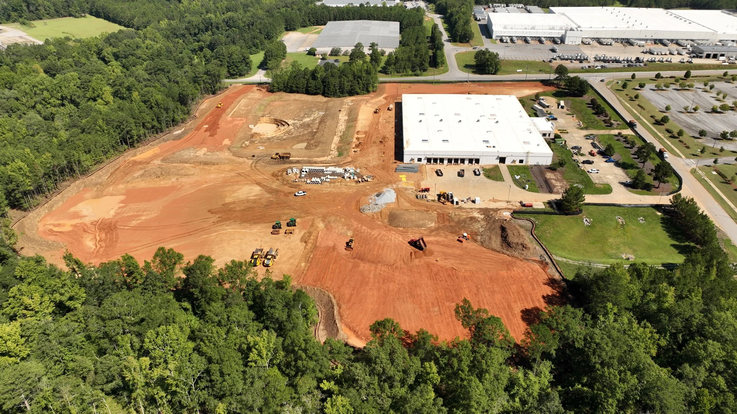
Show owners, investors, and project teams how the work is taking shape. Aerial photography and video create a clear visual record of site conditions, milestones, and visible progress.
Choose monthly visits, milestone coverage, or a schedule built around your project. We plan the views with you and return as the work develops.
Business, Property & Land
A fuller picture. A higher vantage point.
Commercial
Give customers a new perspective on your business. From dealerships and restaurants to shops, car washes, and recreation venues, aerial photography and video capture your location, outdoor spaces, and the experience you offer.
Create imagery for your website, social media, advertising, and business presentations.
Real Estate
Help buyers understand the home, the land, and what surrounds it. Aerial imagery supports commercial and residential listings, acreage, new developments, and completed homes.
Agriculture & Land
Document farms, acreage, facilities, and visible seasonal changes. Use aerial photographs and video to communicate the setting and features of a property, support land-management conversations, or prepare marketing material.
Roof & Exterior Documentation
Capture visible roofs, façades, solar installations, and exterior work before, during, or after a project. Contractors, property managers, and professional inspectors can request the views they need for their own review.
Public Sector & Institutions
Give teams and communities a clearer view of the places they use and manage. Aerial photography and video document schools, parks, municipal properties, and institutional campuses for project updates, communications, and visual records.
From capture to delivery
Imagery
you can put to work.
Choose edited aerial imagery, original files for your own use, or a combination of both. We’ll shape the deliverables around what you need to show, share, or document.
Explore aerial photographs, video, dated progress views, a 360° panorama, and a site-wide aerial mosaic from our work. The annotated-imagery example demonstrates an additional presentation format.
Aerial photographs for progress reports, project records, stakeholder updates, and presentations—or to showcase your business, property, and completed work across websites, marketing materials, and listings.
Individual aerial shots for your website, social media, presentations, or a larger edit. Five construction-site views show a range of framing and movement.
A finished sequence of selected shots, edited to present your property, business, or project clearly.
Photographs organized by visit to help your team follow site conditions, milestones, and visible changes.
Paired views that help illustrate what changed across a project or between visits.
Wide and interactive 360° views that show the site, work areas, and surroundings from one capture point.
Photographs with agreed labels, directional notes, or highlighted features to help explain what the viewer is seeing.
Overlapping aerial photographs brought together in one site-wide view, showing how buildings, access routes, and work areas relate to each other.
Before work begins, we agree on the coverage, file formats, editing, intended use, and delivery schedule. Processing and presentation are coordinated around the agreed project scope.
Aerial Site Mosaic
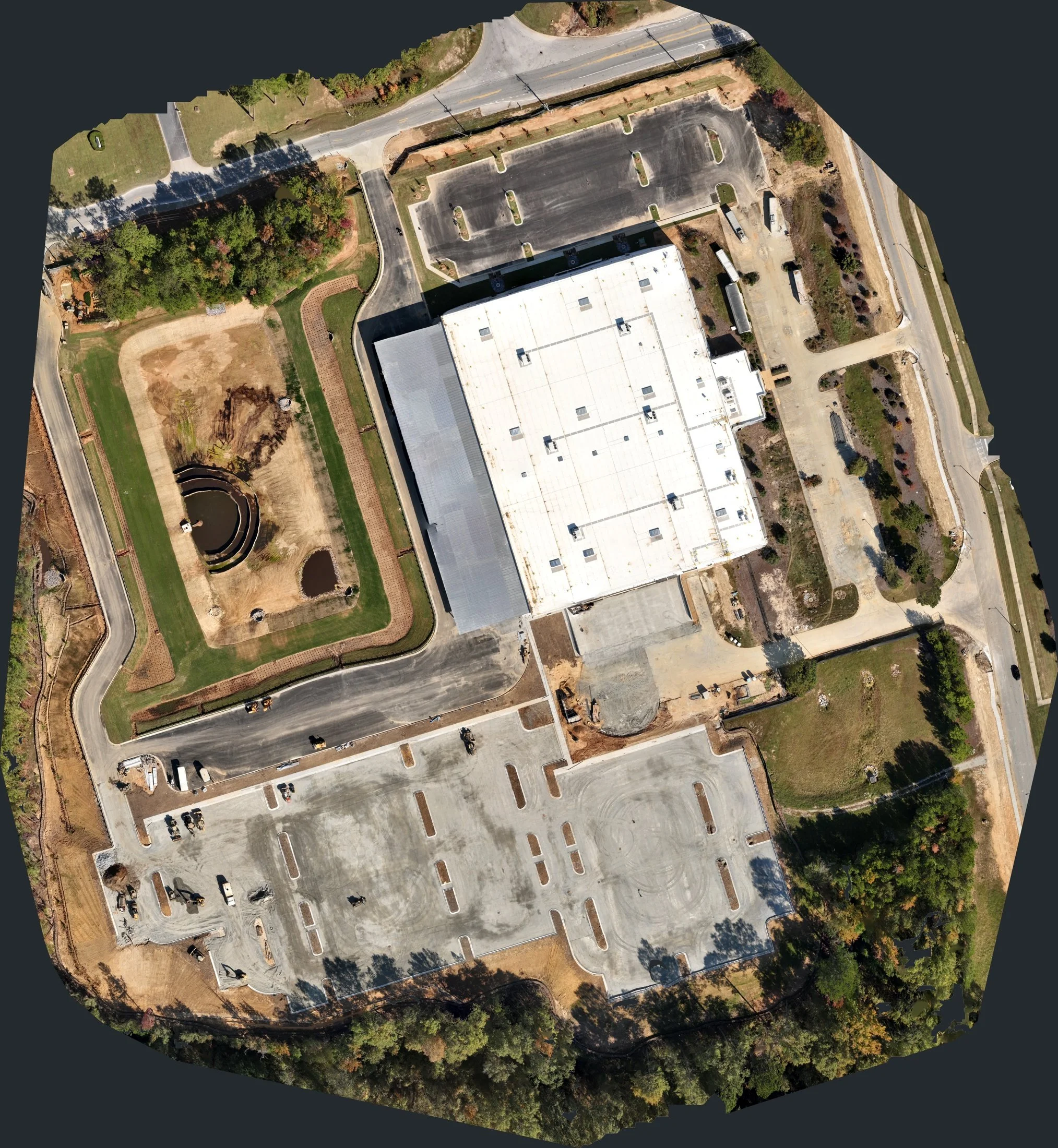
Construction Progress • A site-wide composite assembled from overlapping aerial photographs. Presented for visual reference, not surveying or measurements.
Video Clips
Choose a shot to view it individually. Samples are presented without audio.
Aerial photographs
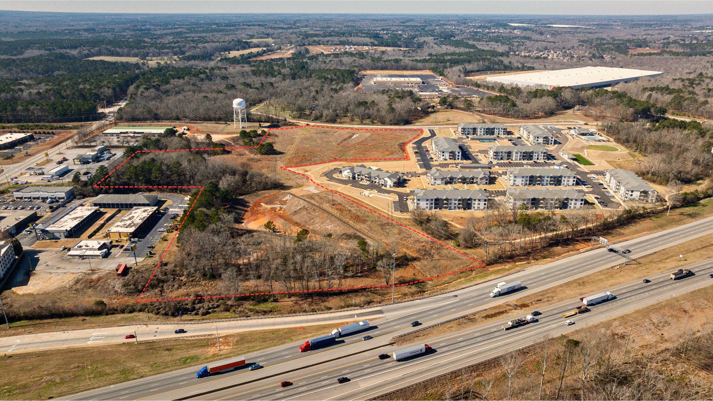
Commercial Property • Aerial imagery with approximate property boundaries. Boundaries are for visual reference, not a survey.
Real Estate
Real Estate • Edited property video • Presented without audio.
Construction Progress · Image sequence
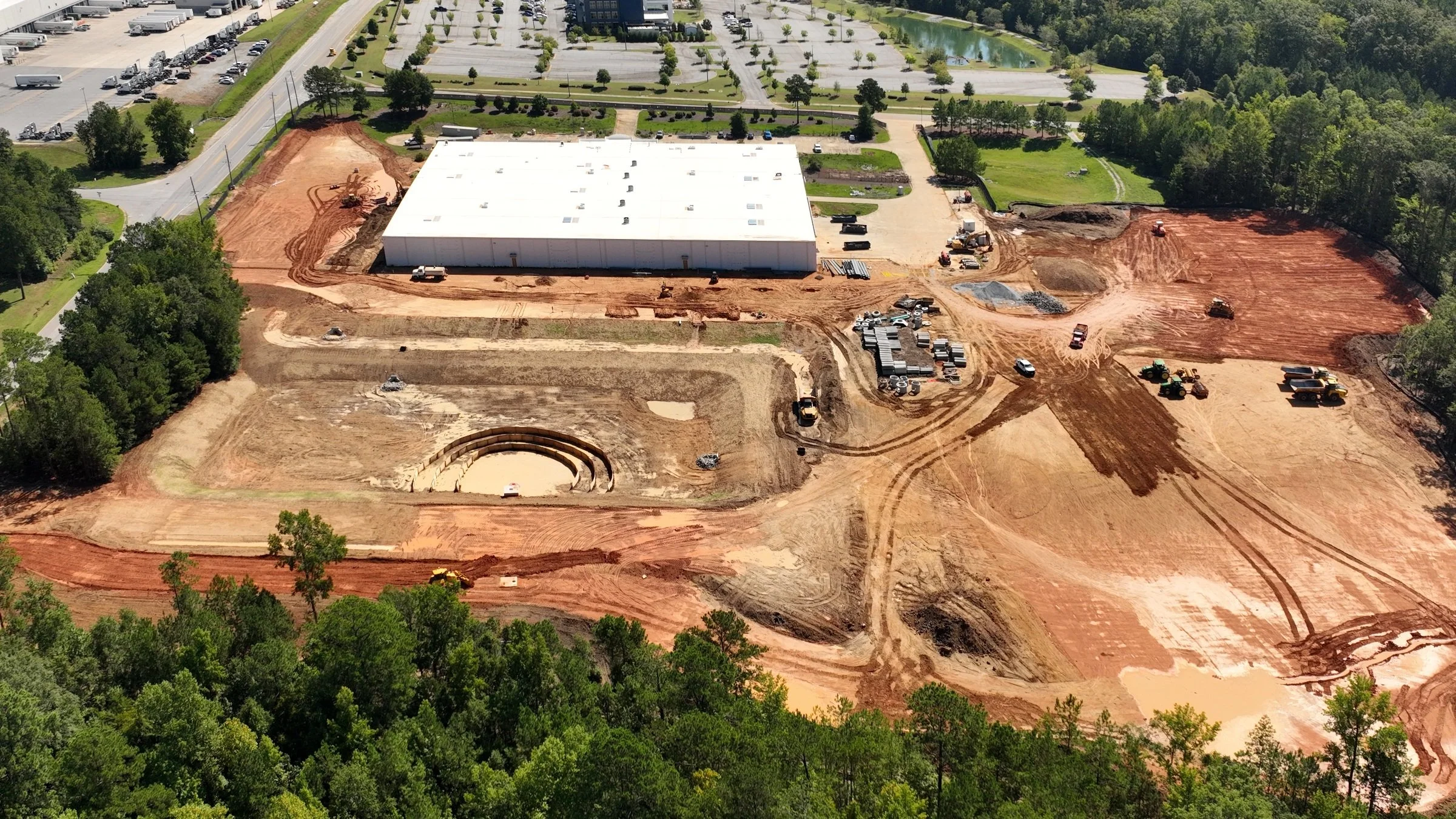
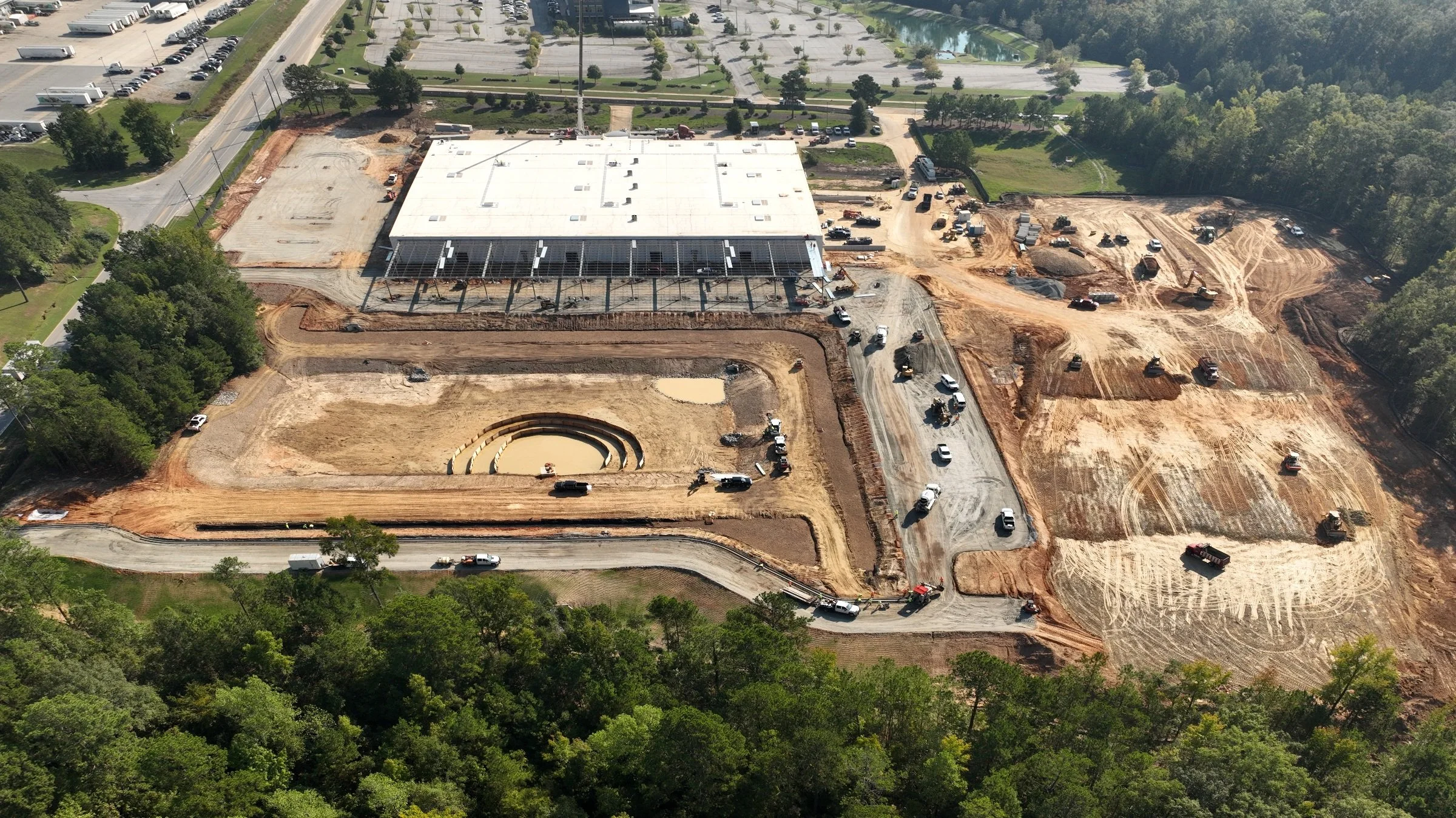
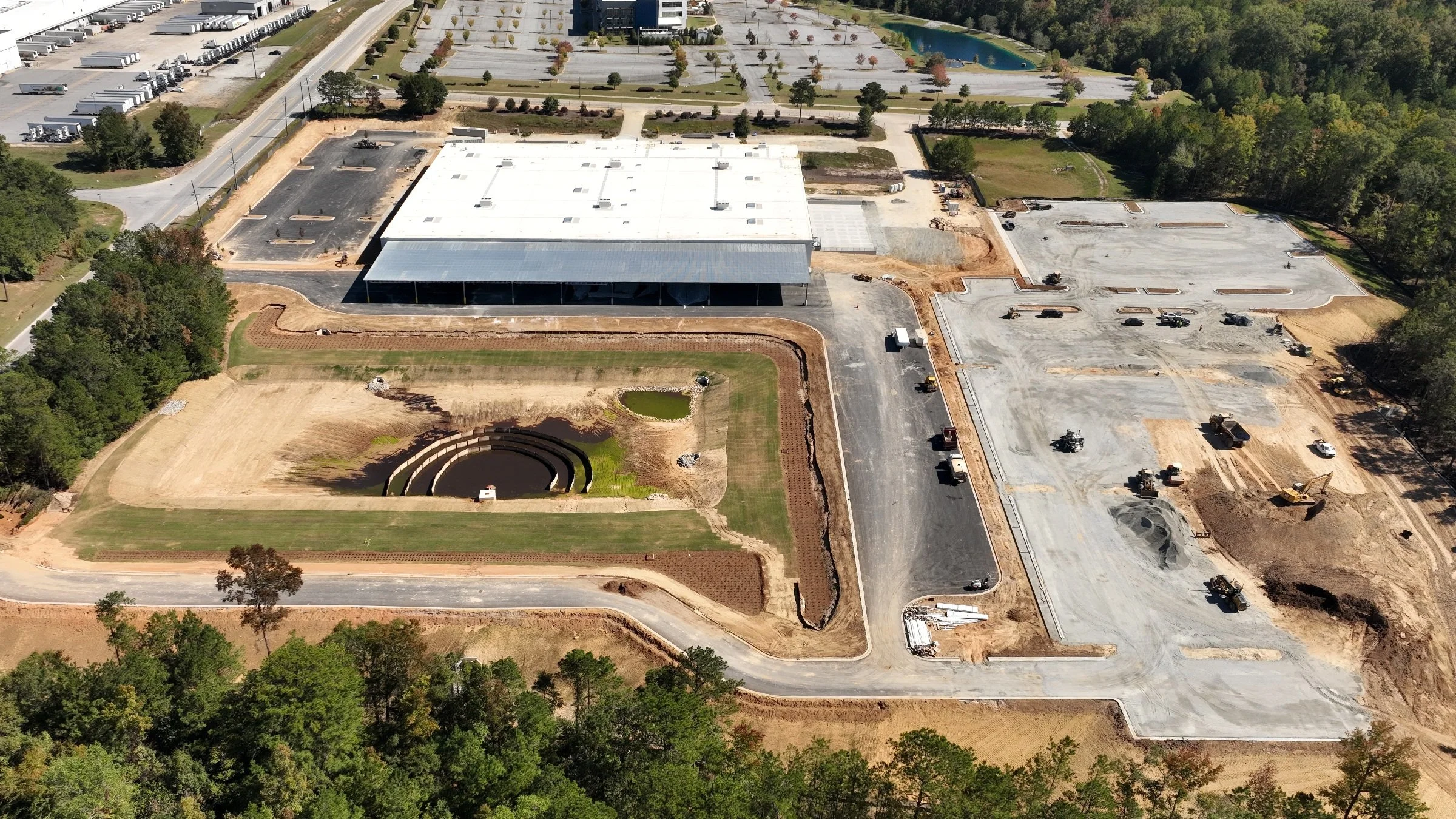
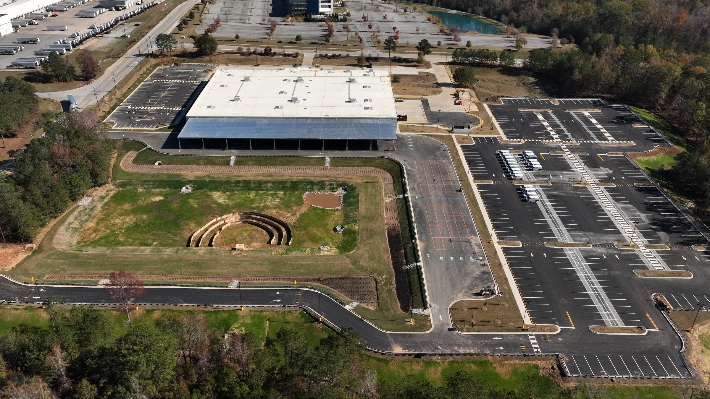
Four visits to the same construction site. Images are aligned and cropped for comparison; camera viewpoints vary slightly.
Construction Progress · Before and after
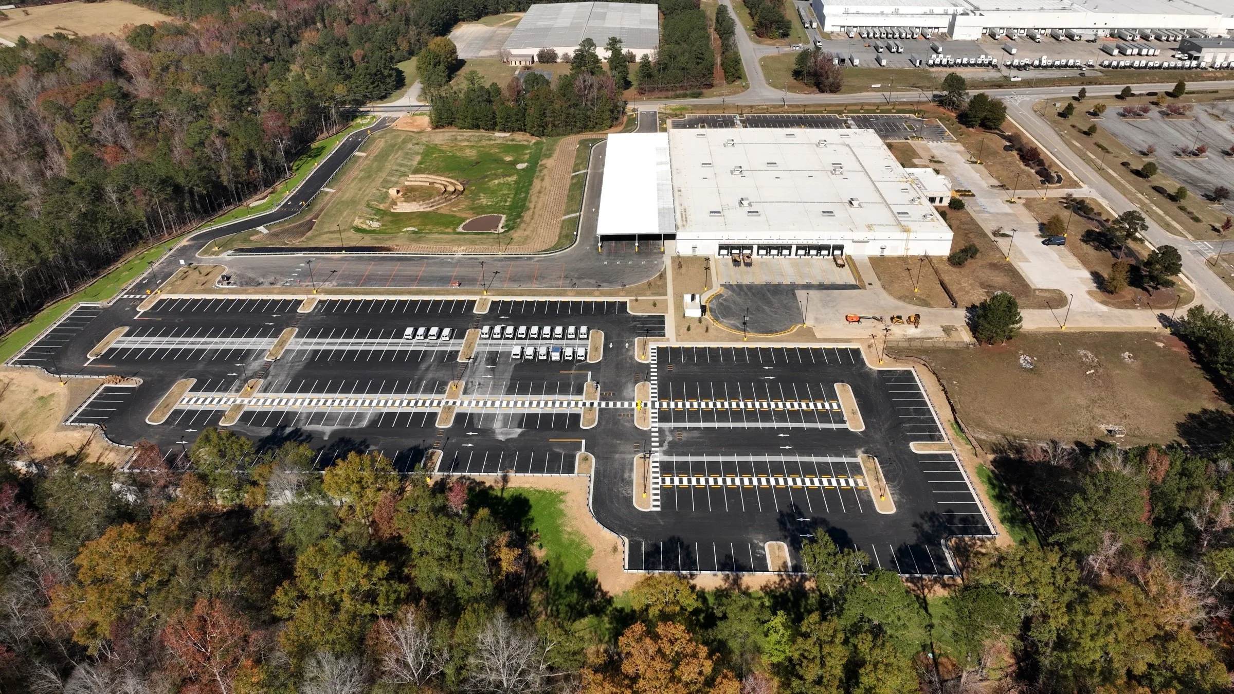
 Before · Month 1After · Month 4
Drag the divider or use the arrow keys to compare Month 1 and Month 4. Same site; slightly different camera viewpoints.
Construction Progress · Inside the construction site
Month 2 · Drag to look around, swipe on a phone, or use the zoom and fullscreen controls. Open the 360° view in a new window ↗
Annotated imagery
Construction Progress • Labels identify site features and intended uses during construction. For orientation, not a survey or engineering assessment.
Specialized aerial data
A specific need.
A place to start.
Need specialized aerial data collection in South Metro Atlanta or elsewhere in Georgia? Start with La Strada Aerials in Peachtree City. Tell us what you need to document, measure, or understand. We’ll review your project and bring together the right specialists, with La Strada coordinating the work and remaining your point of contact.
- Site planning & developmentOrthomosaic mapping, LiDAR, 3D models, stockpile measurements, and large-site processing.
- Buildings & infrastructureThermal imaging, asset documentation, facility scanning, and digital-twin projects.
- Agriculture & landMultispectral crop imaging, irrigation monitoring, livestock location and counting, and land stewardship.
- Water & environmental dataBathymetry, methane detection, and hyperspectral imaging for specialist analysis.
- Specialized access & equipmentConfined spaces, large-area aircraft options, and project-specific equipment requirements.
Your project stays with La Strada. For accepted assignments, we coordinate the specialist work and handle project oversight, scheduling, communication, billing, and delivery—giving you one local point of contact throughout.
Provider availability, technical requirements, qualifications, and deliverables are confirmed before a specialist project is accepted.
Explore specialized servicesThe person behind the perspective
An experienced eye.
A practical approach.
FAA-certified UAS pilot since 2017.
La Strada Aerials is led by Eric Smith, whose background spans more than 35 years in film, television, and commercial production. His work includes serving as cinematographer and drone operator for television shows, documentaries, and docuseries, with hundreds of hours across drone flight, planning, and coordination.
That experience means knowing what to capture, planning the coverage, and delivering imagery that serves a clear purpose—whether you’re tracking construction, presenting a property, or promoting a business.
Raised in Peachtree City, Eric has deep ties to the community and surrounding area. You work directly with him to establish the views you need, coordinate each visit, and prepare photographs and video for the people who will use them.
La Strada Aerials is a division of La Strada Productions.
Practical questions
A few things
before we fly.
What does an aerial photography or video project cost?
Each quote reflects the location, site size, coverage, visit frequency, editing, deliverables, and intended use. Tell us what you need to accomplish and we’ll recommend a scope, with pricing agreed before work begins.
What will I receive, and when will it be ready?
Your project may include edited aerial photographs, video clips, a finished short video, or a dated set of progress images. We agree on the formats, delivery method, and turnaround before the shoot; let us know about listing dates, meetings, or other deadlines when you inquire.
What information do you need to prepare a quote?
Start with the project address or location, what you want to show or document, and your preferred timing. Include any specific views, intended uses, recurring coverage needs, or site requirements. If you’re unsure which deliverables would help, we can work through that with you.
Can you fly at my location, and who handles flight authorizations?
We review the location, airspace, and proposed operation before confirming a shoot and handle flight-authorization requests applicable to our operation. You help arrange permission to access the property and coordinate with the site contact. Any authorization, access, or operating restrictions may affect the coverage and schedule.
What happens if weather or site conditions affect the shoot?
We review conditions and coordinate changes with your site contact when weather, visibility, access, or activity makes the planned flight unsuitable. Any rescheduling arrangements are discussed as part of the project scope, and we keep you informed if timing needs to change.
Are you FAA-certified, and what insurance coverage can you provide?
Eric Smith has held an FAA Remote Pilot Certificate since 2017. Include any required liability limits, additional-insured requests, or certificate-of-insurance requirements with your inquiry so the appropriate coverage and documentation can be confirmed before work is scheduled.
Start a conversation
Tell us what you
need to show.
Share the project location, the kind of imagery you need, and your preferred timing. If you’re planning construction coverage, let us know whether you need one visit, milestone updates, or a recurring schedule.
Request a QuoteBased in Peachtree City.
Serving South Metro Atlanta and surrounding communities, including Fayette, Coweta, Troup, and Upson counties. Projects elsewhere in Greater Atlanta and Georgia can be considered based on location and scope.
Local drone pilots
Introduce yourself.
Interested in working with La Strada Aerials on future projects in South Metro Atlanta? Tell us where you fly, the equipment you operate, your experience, and share a portfolio link.
Use the pilot introduction form to share your background and current capabilities. We welcome introductions for potential project-based collaboration.
Pilot Inquiries