
Commercial & Business
Know your property.
Show its value.
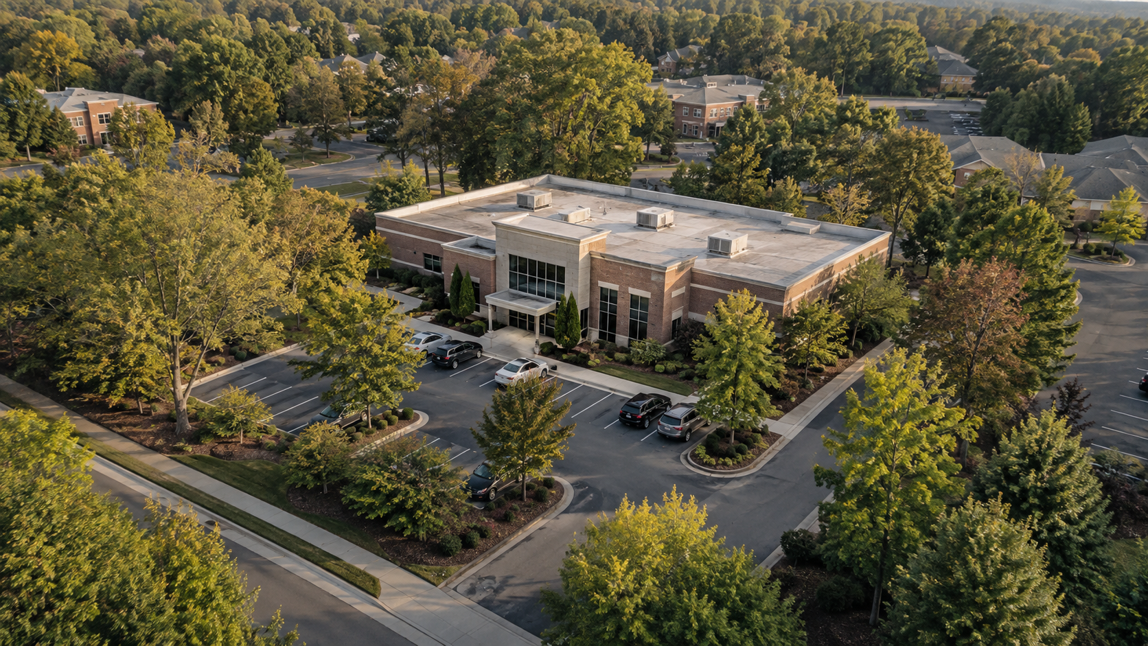
Keep a clear view of your commercial property—what’s there, what’s changing, and what makes the location valuable. La Strada Aerials provides aerial and ground-level photographs and video to document conditions, follow improvements, and present your property to owners, tenants, customers, and project teams.
Whether you’re coordinating exterior work, updating a property record, leasing a space, or promoting your business, we plan the views around what you need people to see and understand.
Serving businesses, commercial property owners, and managers across South Metro Atlanta.
Request Business CoverageFor owners, managers & businesses
See the whole property.
For owners and property managers
You need to know what’s happening at the property—even when you can’t be there. Dated aerial and ground-level photographs help you review paving, landscaping, and exterior improvements, compare visible conditions before and after work, and give contractors and off-site owners a shared reference. Keep an organized record for maintenance planning, insurance documentation, and questions about what changed or when work was completed.
For businesses attracting customers or tenants
People need to picture how a location will work for them before they visit or inquire. Show prospective tenants how the building, parking, entrances, and surrounding businesses fit together. Help customers see the outdoor spaces, facilities, and setting that make your business worth visiting. We plan photographs and video around those selling points, ready for your leasing materials, website, social media, or advertising.
Built around your purpose
What do you need to accomplish?
Keep a record you can return to.
Document the property before repairs, follow exterior improvements, or refresh your records across multiple locations. Choose a single visit or scheduled updates, with dated photographs organized for comparison and reference.
Help prospects evaluate the location.
Show available space in the context of the whole property—buildings, entrances, parking, and nearby amenities. Give prospective tenants and buyers useful views for comparing locations and deciding whether to arrange a visit.
Show what makes a visit worthwhile.
Highlight the facilities, outdoor spaces, and setting that customers won’t see in a storefront photograph. Build a set of photographs and video for your website, social media, and advertising, with fresh coverage as your business changes.
For example / Car dealerships
Show the showroom.
The lot. The location.
Give customers a clear view of your dealership before they arrive. Planned aerial photographs can show the showroom exterior, vehicle lot, entrances, parking, and surrounding area.
Use a short aerial sequence on your website or in a social or advertising edit. Refresh the imagery after a renovation, expansion, or other meaningful change to the property.
We agree on the views, intended use, and a suitable capture window with your site contact before the shoot.
What you receive
Ready for your
next update.
- Edited aerial photographs of the property and selected surroundings.
- Wide site views and closer compositions agreed in the coverage plan.
- Selected aerial video clips or a finished short video for your website, social channels, or advertising.
- Dated image sets when documenting changes or recurring visits.
Panoramas, client-approved labels, reference overlays, and comparison images can be scoped when they help explain the property.
We agree on the views, image quantities, video editing, formats, intended usage, and delivery timing before the shoot. The finished work is prepared around your actual use.
Clear visual information
Direct attention
to what matters.
Visual data collection can provide a dated photographic record of the property and its visible features. For presentations, simple labels can identify buildings, entrances, parking areas, or client-designated features.
Any property-line overlay uses an identified reference supplied or approved by the client. It is a presentation aid, not a surveyed boundary or measurement.
For a property still under development, explore our construction progress coverage.
How it works
Start with what
you need to show.
1. Define the purpose.
Share the address, business or property type, audience, timing, and intended use. We identify the views and deliverables that matter.
2. Plan the visit.
Coordinate access and site readiness with your contact, and review flight feasibility and suitable conditions for the capture.
3. Capture and prepare.
Photograph and film the agreed views, then select and edit the imagery for a consistent presentation.
4. Deliver for your use.
Receive the agreed photographs and video in the planned formats. Future visits can document improvements or refresh the property's imagery.
An experienced visual eye
Considered coverage.
Polished presentation.
You work directly with Eric Smith, a cinematographer and drone operator whose background spans more than 35 years in film, television, and commercial production.
That background informs the framing, the sequence of views, and the finished edit. We plan imagery that communicates the property clearly and fits the way your business will use it.
La Strada Aerials is a division of La Strada Productions. Our aerial services focus on businesses, properties, land, and project documentation.
Practical questions
Before we get started.
What can aerial photography show about my business that ground-level photos cannot?
An aerial view can connect your building with its setting: entrances, parking, outdoor spaces, nearby roads, and the scale of your location. We choose views that help customers understand where you are and what makes the place worth visiting.
Can you create photos and short videos for our website, social media, and advertising?
Yes. We can prepare edited photographs, video clips, or a finished short aerial video for the uses agreed in your brief. Share the platforms, preferred formats, and any campaign requirements before the shoot so the coverage supports them.
Can you show our location, entrances, parking, outdoor spaces, and nearby surroundings?
Yes, where the location and operating conditions allow. We build a shot list around the features that matter to your customers and review nearby airspace, neighboring properties, and site activity when planning the coverage.
Can you film while we’re open, or should we schedule before or after business hours?
Either may be appropriate depending on the views, customer activity, and flight plan. We coordinate with you to choose a practical time and manage access to the operating area; a quieter period may allow cleaner views and simpler coordination.
Can you work with our marketing team or the person who manages our website?
Yes. We can plan coverage around their brief and agree on formats, framing, and intended uses before capture. You retain a direct point of contact with La Strada throughout the project.
Can we schedule new imagery when our property, inventory, or seasonal offerings change?
Yes. Coverage can be planned around improvements, seasonal presentation, or other meaningful changes at your location. We can discuss repeat visits so your marketing imagery stays relevant.
Let’s plan the next view
Tell us about
your business.
Share your location, the business or property you want to show, and your preferred timing. Tell us whether you need imagery for a website, social media, advertising, a property presentation, or ongoing visual documentation.
Request Business CoverageBased in Peachtree City.
Serving South Metro Atlanta and surrounding communities, including Fayette, Coweta, Troup, and Upson counties. Other Georgia projects can be considered based on location and scope.
La Strada Aerials · An Elevated Perspective
Explore all aerial services →