
Drone Services for Agriculture, Forestry & Land
Understand your land. Follow the changes.
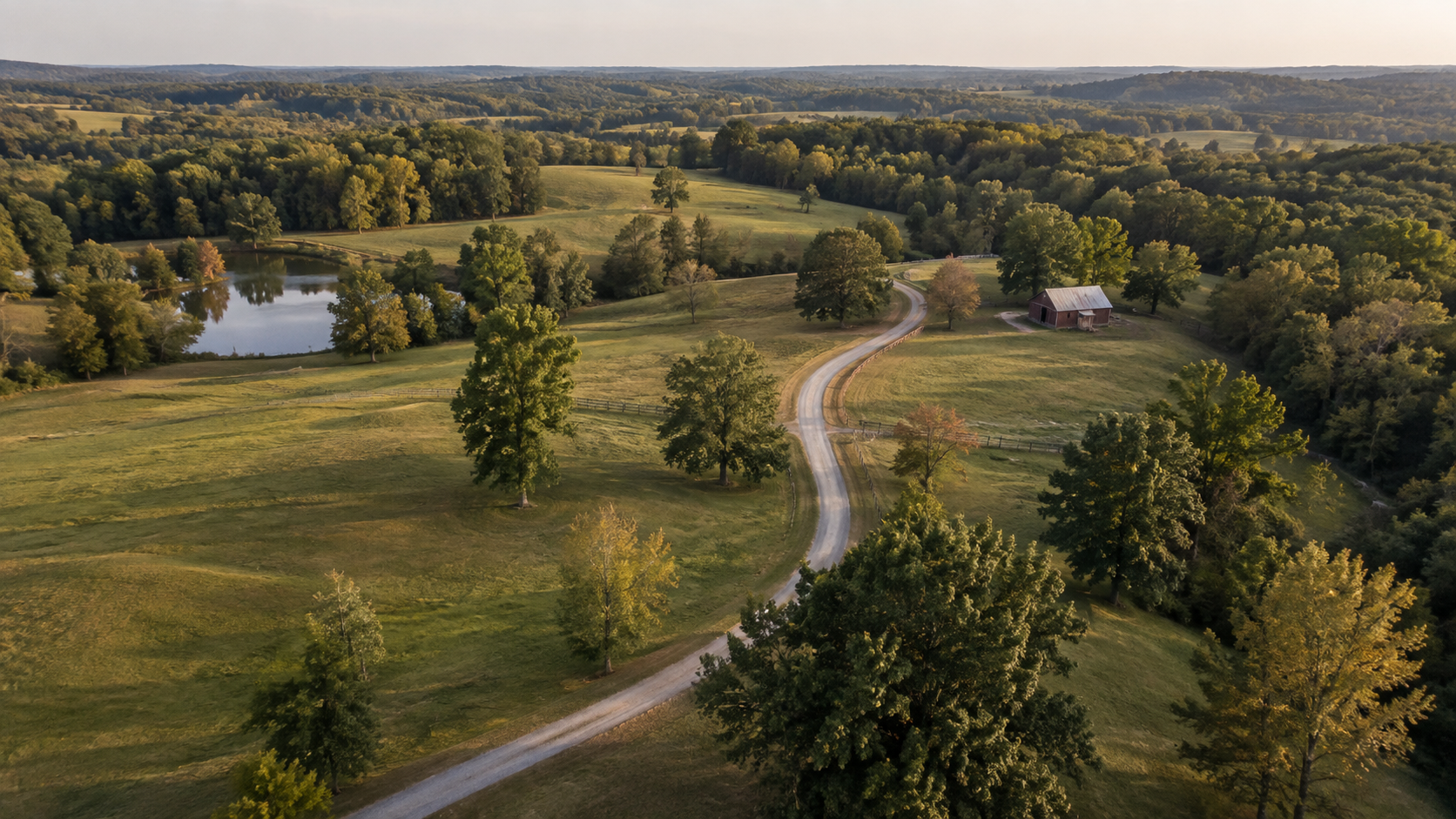
See the condition of fields, wooded areas, access routes, and water features in the context of the whole property. Dated imagery helps you compare visible changes after storms, clearing, seasonal growth, or improvements—and decide where a closer look is needed.
We plan coverage around the questions you have about the land, whether you are briefing a contractor, documenting restoration work, maintaining property records, or presenting acreage for sale. Single visits or repeat coverage provide organized photographs and video for your next conversation, site visit, or land-management decision.
Serving landowners, farm businesses, and rural-property professionals across South Metro Atlanta.
Discuss Your Land ProjectFor your next site conversation
Give everyone the same
point of reference.
When you are discussing access with a contractor, introducing acreage to a prospective buyer, or reviewing changes with someone off site, a dated aerial overview gives the conversation a shared starting point. Show the area being discussed and how it connects to the rest of the property.
Tell us which places and features you need people to recognize. We can plan overall views, selected closer photographs, or repeat visits to record visible changes, then organize the imagery for the conversation, presentation, or property record you have in mind.
Coverage with a purpose
One landscape.
Several useful perspectives.
Show the operation.
Present fields, barns, facilities, and the wider setting with aerial photographs and video for your website, outreach, or business story.
Give the property context.
Help viewers understand the visible features and setting of acreage, rural listings, and land with a considered selection of aerial views.
Follow visible changes.
Arrange repeat visits to photograph seasonal changes, site work, or other visible conditions from agreed viewpoints.
What you receive
Imagery for the
way you use the land.
- Edited aerial photographs showing agreed property features.
- Wide context views and selected closer compositions.
- Aerial video clips or a scoped finished video for presentation or marketing.
- Dated image sets for repeat visits, with agreed labels or reference overlays.
Visual data collection means capturing photographs and video for documentation and communication. Coverage, file formats, editing, intended usage, and timing are agreed before the visit.
Reference overlays use an identified client-supplied or approved source. They do not establish surveyed boundaries or verified acreage.
How it works
Start with what you need to see.
1. Define the purpose.
Share the location, approximate property size, features of interest, and how the photographs or video will be used.
2. Plan access and coverage.
Coordinate with the owner or site contact. We review flight feasibility, suitable conditions, and practical coverage for the property.
3. Capture the agreed views.
Photograph and film the planned features. Repeat visits can follow agreed viewpoints while allowing for changing conditions.
4. Prepare the imagery.
Receive the selected and edited files in the agreed formats, with dates and labels where included in the scope.
Production experience
An experienced eye.
A useful perspective.
You work directly with Eric Smith, a cinematographer and drone operator whose background spans more than 35 years in film, television, and commercial production.
That background brings a considered approach to composition and storytelling, whether the assignment is a straightforward visual record or a finished film introducing a farm, property, or place.
La Strada Aerials is a division of La Strada Productions.
Practical questions
Before we get started.
Can you document a large property and the features we want to see?
We plan coverage around the property’s extent, access, terrain, and the features you identify. Share a location and reference map if available; we’ll confirm a practical scope and whether multiple launch locations or visits are needed.
Can you return to show seasonal changes or the progress of land improvements?
Yes. Repeat visits can document visible seasonal changes, clearing, access improvements, or other work on the property. We plan useful comparison views and a schedule suited to the changes you want to follow.
Can you photograph access roads, fields, ponds, buildings, and other areas we identify?
Yes, subject to access and safe flight conditions. A marked reference map or a short discussion with someone familiar with the property helps us prioritize the features and views that matter.
Can we use the imagery to market the property or communicate with people who cannot visit?
Yes. Aerial photographs and video can help show the setting, layout, and visible features to buyers, owners, or project participants. We agree on the intended audience, usage, and delivery formats before capture.
How do you plan flights around livestock and activity on the property?
We ask about livestock locations, sensitive areas, equipment, and scheduled activity before the visit. We coordinate timing and operating areas with your site contact and adjust or stop the flight if conditions make the planned coverage unsuitable.
Does your service include crop-health analysis, acreage measurements, or surveying?
Standard land coverage documents visible conditions through photography and video. If your project needs multispectral imaging, mapping, measurements, or specialist analysis, share the requirements so we can explore an appropriately qualified provider and define a separate scope.
Let’s plan the next view
What would a wider
view help you show?
Tell us where the property is, which features matter, and whether you need a single visit, repeat documentation, or marketing imagery.
Discuss Your Land ProjectBased in Peachtree City.
Serving South Metro Atlanta and surrounding communities, including Fayette, Coweta, Troup, and Upson counties. Other Georgia projects can be considered based on location and scope.
La Strada Aerials · An Elevated Perspective
Explore all aerial services →