

Construction Drone Services
A clear record. From the ground up.
Know what the site looked like before work began, what’s changed, and how the project is progressing. Dated aerial and ground-level imagery gives your team a record of visible conditions, milestones, and completed work to return to when questions arise.
Use that record for owner updates, contractor coordination, insurance documentation, or reviewing questions about site conditions and completed work. We plan the key views with your team, coordinate access, and organize each visit’s photographs and video for practical use—from a single milestone to weekly or monthly coverage.
Serving contractors, builders, and developers across South Metro Atlanta.
Request Construction CoverageBuilt for your next project update
Show the progress.
Keep the record.
When an owner or project partner asks what’s changed, dated aerial photographs give you something clear to put in front of them. Show the overall site, bring attention to active work areas, and compare visible changes between visits—all in imagery you can return to as the project develops.
We agree on the key viewpoints and details with your team before the shoot, then prepare the photographs and video around how you’ll use them. Bring them into an owner update, share them with off-site stakeholders, or build a record for your completed-project presentation.
Coverage that fits the project
One milestone.
Or the whole build.
Capture the site now.
Establish a visual baseline, document a particular stage, or create an overview for an upcoming presentation.
Show the turning points.
Plan coverage around the stages your team wants to communicate, from early site work through visible building progress and completion.
Build a visual record.
Choose weekly or monthly visits, or another agreed cadence. Revisit planned viewpoints where conditions allow and keep each visit’s imagery organized by date.
Progress over time
See what’s changed.
Keep track of the work.
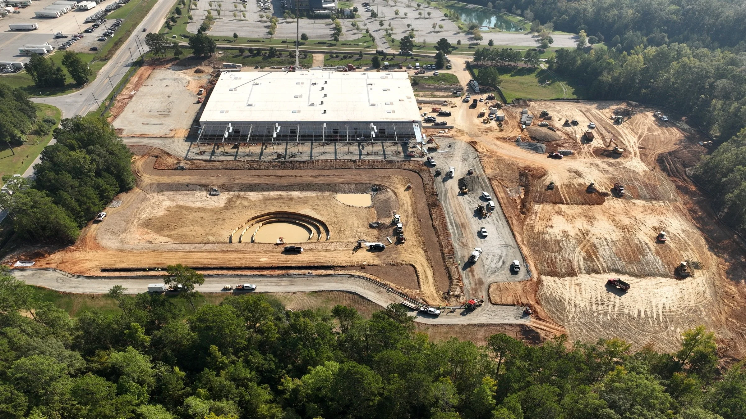
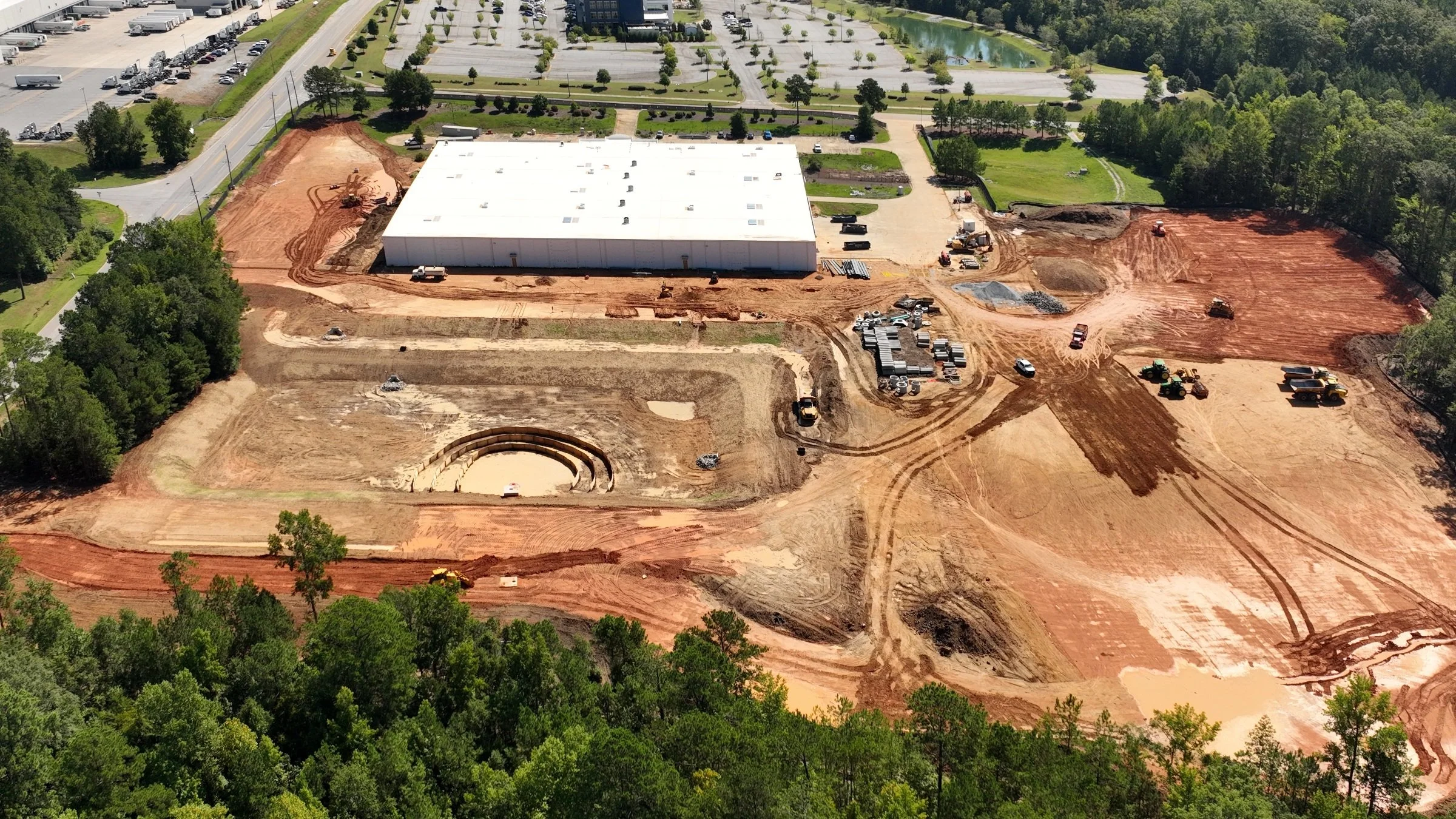
Three views from the same construction site show how a dated photographic record brings change into focus.
Before the next phase
Establish the context.
Show the site and its surroundings before the next phase of work.
During construction
Follow visible progress.
Give your team current photographs and selected views that help explain what has changed.
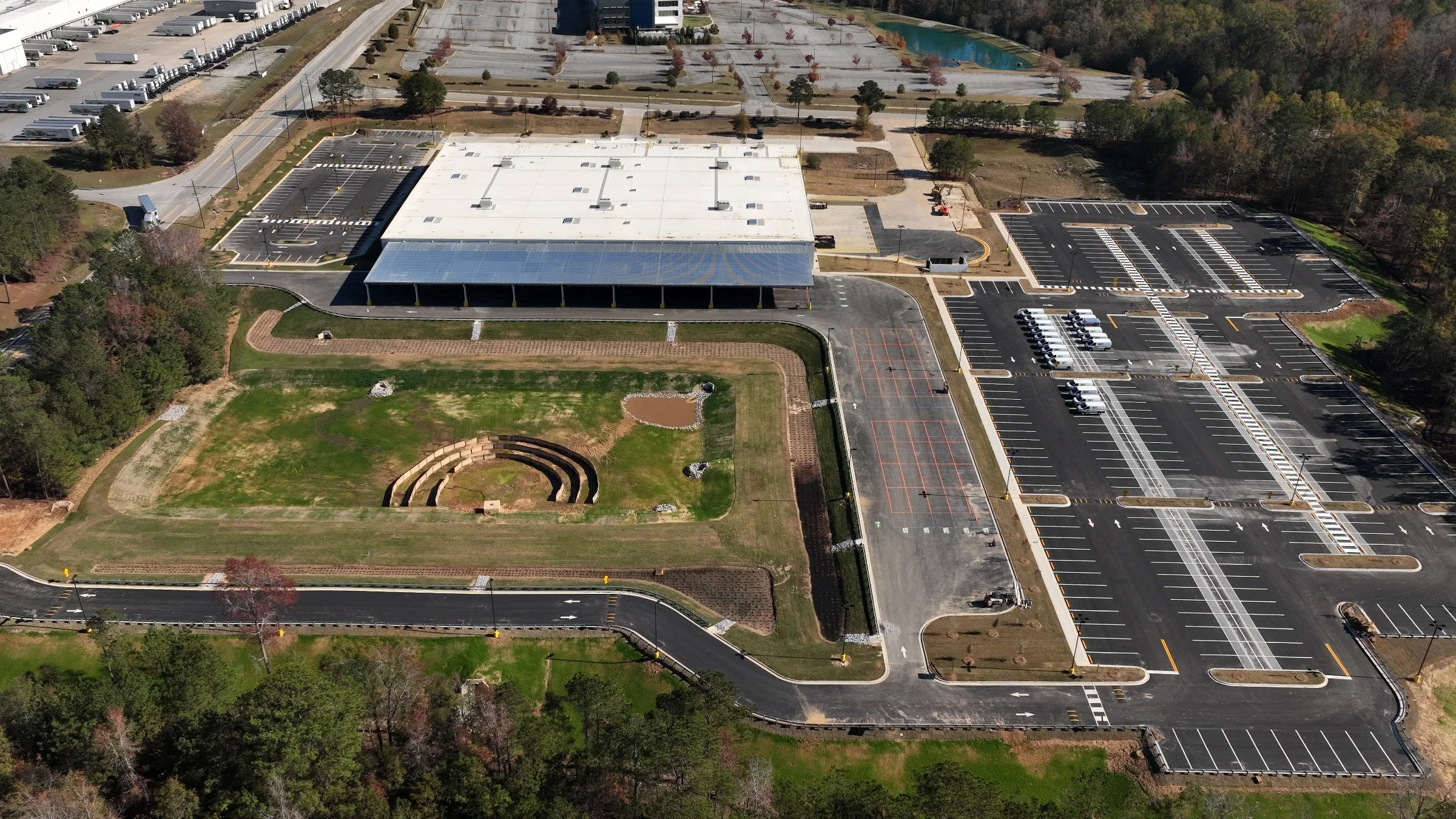
As work takes shape
Show the results.
Build a photographic record of completed work for project updates, presentations, and marketing.
Photographs from separate visits. Viewpoints vary slightly.
What you receive
Imagery your team
can put to work.
The right imagery for your next update.
Show an owner what’s changed, give an off-site team a clearer view of the work, or present the finished project. Tell us who needs to see it and what you want them to understand—we’ll help you choose the photographs, video, and interactive views that serve that purpose.
Your coverage is built around the project. Before the shoot, we agree on the key views, deliverables, file formats, intended use, and delivery timing. Labels, comparisons, and finished edits can be included where they help tell the story.
Plan your project coverageHow it works
Planned around your site.
1. Plan the coverage.
Tell us the location, project stage, desired views, timing, and intended use. We agree on scope and coordinate with your site contact.
2. Collect the imagery.
Capture the agreed site overviews and selected details when access, weather, and flight conditions allow.
3. Prepare the delivery.
Review and edit the imagery, organize the visit by date, and prepare the agreed photographs and video.
4. Revisit as work develops.
For recurring coverage, coordinate the next visit and refine the views as the project changes.
Practical questions
Before we get started.
Can you return regularly to document our project?
Yes. We can plan weekly or monthly visits, milestone coverage, or another schedule around the work you need to document. We agree on the key views, site contact, and deliverables so each visit contributes to a useful visual record.
Can you capture consistent views so we can compare progress over time?
We plan repeat viewpoints and framing to make changes easier to follow from visit to visit. Flights adapt to weather, access, and site activity, so these are visual comparisons rather than surveyed or precisely registered measurements.
Can you coordinate with our superintendent and work around an active jobsite?
Yes. We coordinate access, timing, launch areas, and the views you need with your designated site contact. Let us know about inductions, protective equipment, restricted areas, and active operations so they can be included in the plan.
What will we receive after each visit, and can we share it with owners, investors, and project teams?
We agree on an edited photo set, video coverage, or both, with dated files organized for the way your team reviews progress. Tell us who will use the imagery so internal updates, investor presentations, and any public marketing use are included in the agreed scope.
Can you document the site before work begins and photograph the completed project?
Yes. Before, during, and after coverage can show how the site develops, while completed-project imagery can support your portfolio and marketing. Planning the first visit early gives us a useful starting point for later comparisons.
Is this visual documentation, or does it include measurements, mapping, or inspections?
Construction progress coverage provides photography and video of visible site conditions. If you need measurements, mapping, a 3D model, or technical inspection support, tell us the required outcome; we can explore a specialist scope and confirm the appropriate provider, deliverables, and professional responsibilities before quoting.
Let’s plan the next view
Tell us what
you’re building.
Share the site location, project stage, preferred timing, and whether you need a single visit or recurring coverage.
Request Construction CoverageBased in Peachtree City.
Serving South Metro Atlanta and surrounding communities, including Fayette, Coweta, Troup, and Upson counties. Other Georgia projects can be considered based on location and scope.
Explore all aerial services →